
GeoDrones
Geophysical mapping and monitoring of natural hazards using multi-purpose UAVs.


Geophysical mapping and monitoring of natural hazards using multi-purpose UAVs.
Norwegian CCS Research Centre – Task 12: Cost-efficient monitoring.
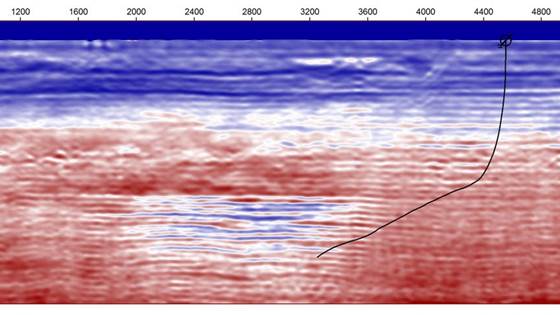
The primary objective of the project is to develop a novel cost-efficient method for tophole/non-invasive monitoring of permanently plugged wells that are cut below surface/seafloor.

TIGER is a fully featured 3D finite-difference modeling program. Through efficient parallelization, it can provide synthetic 3D data sets to optimize survey layouts, aid interpretation, test new processing techniques – all within days on industrial...

SINTEF Drone Laboratory is an arena for development of drone hardware and software.

SINTEF Pore Imaging Laboratory is an advanced national and European research infrastructure comprised of multifaceted X-ray imaging facilities, with advanced analysis tools, and fast computing power.