To main content

Geophysics

Geophysics is the main activity which is primarily related to seismic processing methods for structural imaging of the subsurface.

Contact person

  • High-resolution seismic modelling and inversion

  • Electro-magnetic, gravity, magnetic modelling and inversion

  • Integration (joint inversion) of multiple datasets

  • Quantitative geophysical methods

  • Computation of uncertainties in geophysical imaging

  • Bandlimited optAVO

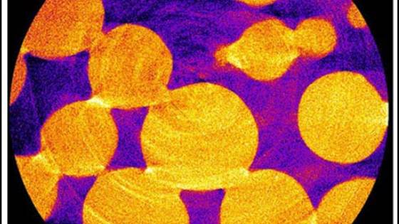
  • Porescale measurements

  • 4D at Laboratory scale

  • Seismic dispersion and attenuation

Our on-going CO2 monitoring Projects

COMPLETE

COMPLETE

Start:
End:

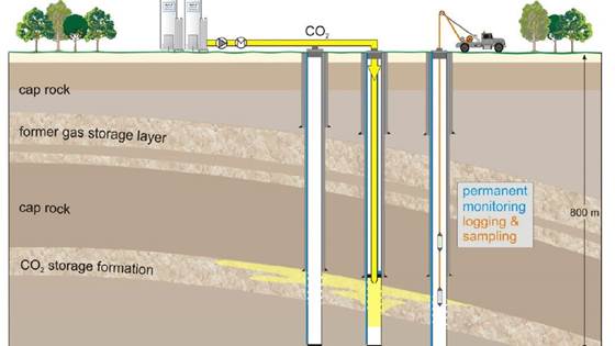
Joint inversion and petrophysical characterization for improved CO2 monitoring at Ketzin and Svelvik.

uniCQue

uniCQue

Start:
End:

Uncertainty reduction in monitoring methods for improved CO2 Quantity estimation

aCQurate

aCQurate

Start:
End:

Accurate CO2 monitoring using Quantitative joint inversion for large-scale on-shore and off-shore storage applications.

CO2CAP

CO2CAP

Start:
End:

An innovative concept for time-dependent monitoring of CO2 plume expansion by combining active and passive seismic data.

ECCSEL (phase 2)

ECCSEL (phase 2)

Start:
End:

ECCSEL Svelvik CO2 Field Lab; ECCSEL National Imaging Lab.

Pre-ACT

Pre-ACT

Start:
End:

Pressure control and conformance management for safe and efficient CO2 storage - Accelerating CCS Technologies.

QUASAR

QUASAR

Start:
End:

QUAntitative measurements of partial saturations in Brine-CO2 SAturated Rocks at pore scale.