GPU Ocean
A GPU-accelerated simulation framework for running large ensembles of simplified ocean models for real-world domains.

Observations are essential for correcting model estimates and improving forecasts. Yet measurements of the ocean are sparse compared with the areas we need to describe. Detailed ocean models are also computationally expensive, which can limit the number of possible outcomes we can explore. We develop fast numerical models and ensemble-based methods to make effective use of observations and quantify uncertainty in predictions.
We combine expertise in numerical flow modelling, data assimilation and GPU computing. We work with research organisations and other partners to:
Contact our Applied Computational Science research group to discuss a modelling challenge or the development of new computational and data assimilation methods.
In collaboration with the Norwegian Meteorological Institute, we initiated the development of GPU-based simulators for barotropic dynamics described by the shallow-water equations. These models describe variations in water level and depth-averaged currents, providing an efficient basis for studying coastal circulation and storm surges.
The GPU Ocean project, with NTNU as an educational partner, produced numerical methods and open-source software for running large ensembles of thousands of simplified ocean models. The methods and computational tools are described, for example, in Holm (2020).
Running many simulations with different initial conditions and forcing allows us to explore a range of possible outcomes. The simplified models are nested within operational three-dimensional ocean models, which provide initial states, bathymetry, forcing and boundary conditions. This enables us to investigate local uncertainty and dominant physical processes within the context of a larger ocean forecast.
An ensemble represents a range of possible states and how they may evolve. As observations become available, they can be used to update the ensemble. Data assimilation combines information from measurements and models while accounting for uncertainty in both.
We develop and compare ensemble-based methods, including ensemble Kalman methods, particle filters and multilevel methods. Depending on the method, observations are used to adjust model states or the weights assigned to individual simulations. Our work addresses forecast quality, uncertainty estimates and computational cost.
Sparse ocean observations pose particular challenges. We investigate how a limited number of measurements can inform updates to a larger current field, and how uncertainty subsequently evolves. For search and rescue and other drift applications, a key question is how uncertainty in ocean currents affects predicted drift trajectories.
GPU acceleration makes large ensembles computationally feasible. Multilevel methods also allow simulations with different resolutions and costs to be combined, making more effective use of computational resources.
Together with the Institute of Marine Research and the Norwegian Meteorological Institute, with NTNU as an educational partner, we have developed technology and methods for tailored ocean forecasts. This work includes receiving user observations, adapting model domains, assimilating data and presenting forecasts to both recreational and professional users.

In the Havvarsel project, the methods were explored through applications in search and rescue, aquaculture and recreation, including forecasts of bathing temperatures. The havvarsel.no service illustrates how ocean forecasts can be made accessible to different user groups.
Through the GOSPEL project, we have also investigated GPU-accelerated ensembles for estimating uncertainty in oil spill transport. These applications share a need for fast computations that combine available observations with a representation of several possible outcomes.
A GPU-accelerated simulation framework for running large ensembles of simplified ocean models for real-world domains.
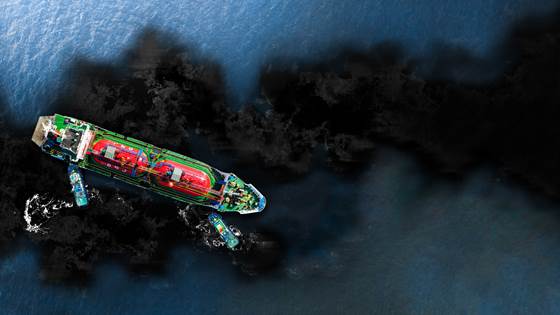
GOSPEL aims to leverage GPU-accelerated simplified ocean models to investigate and estimate uncertainties in short-term predictions of the spread and fate of oil spill at sea.
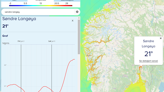
Preparing for the next generation ocean forecast services through improved technological and methodological solutions for receiving user observations, forecast model subsetting, data assimilation, and finally displaying tailored forecasts to users.
It is important to predict the drift trajectories of oil spills, ice bergs, and other floating objects to protect the marine environment and for safe offshore operations.