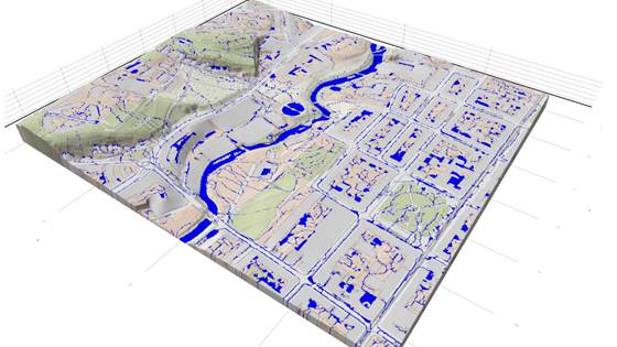
SWIM
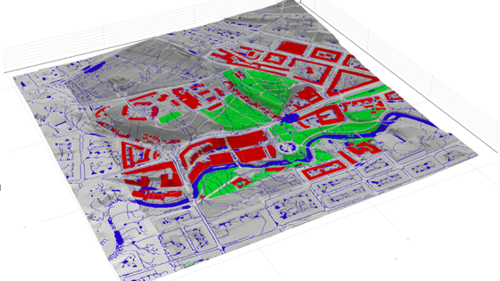
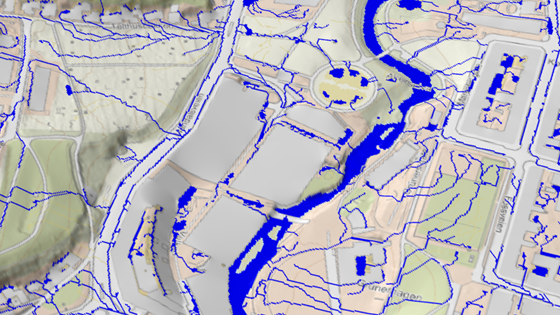
Software for static modeling and prediction of surface water and urban flooding based on analysis of topography/terrain.

Our engagement with surface water and flooding events dates back to the early 2000s and originates from mathematical research on high-resolution schemes for hyperbolic conservation and balance laws conducted by our current research manager before joining SINTEF. In 2003, we initiated investigations into utilizing graphics cards for solving partial differential equations (PDEs). Shallow-water simulations became a logical starting point, given their explicit stencil computations and involvement of three components (water height and momentum in two axial directions) aligning with the colors red, green, and blue, which we manipulated through shaders to solve PDEs. Dambreak problems served as effective test cases, offering the potential to integrate simulations with advanced graphics for visually appealing visualizations; see, e.g., Hagen et al. (2007).
A series of developments unfolded, leading us to actively engage in GPU-accelerated simulation of dambreak-induced flooding in collaboration with the National Center for Computational Hydroscience and Engineering, Mississippi; see Brodtkorb et al. (2012), Sætra (2014) and Sætra et al. (2015) or watch an old animation showing simulations of dambreaks, tsunamis, and storm surges. The code that emerged from this collaboration was later tailored for investigating urban flooding scenarios and subsequently licensed to a reputable engineering firm in the UK.
The second avenue of exploration begins with algorithms designed to identify the potential for structural trapping in CO2 storage, drawing inspiration from natural analogs in watershed analysis. Guided by our commitment to transferable knowledge (and encouraged by results from our master student Voldsund (2017)), we later found ourselves modifying these algorithms to aid the startup company Spacemaker in developing tools for predicting urban flooding and mitigating damage from heavy rainfall. This adaptation was successfully integrated into their product, as detailed in articles on tekna.no and gemini.no (Spacemaker was subsequently acquired and transformed into AutoDesk Forma).
We are corrently working in three main directions:
We also have the possibility of using our GPU Ocean code to study storm surges resulting from extreme weather events.
Software for static modeling and prediction of surface water and urban flooding based on analysis of topography/terrain.
Reducing societal risk in a changing climate using nature-based solutions in sustainable urban area development
SWAMP aims at developing open-source software for simulation and analysis of surface water caused by flooding and intense rain, and using this simulation software to make demonstrators show casing our experience and expertise.

SINTEF was the research partner in the innovation project OptiSite, led by Spacemaker (now part of Autodesk). The project contributed to developing Spacemaker from a start-up idea to an established product with international presence.