WP02 Concept definition
Lead:
Kongsberg Seatex
Objectives
The objectives of this WP is to describe in detail the concepts which shall be developed during the H2H-project.
Participants:
SO: Contribution on user needs and requirementsMOI: Contributions on need related to automooringSD: Contributions on communications
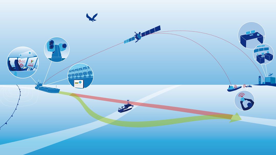
The main concept in this task is to define what kind of data is available and necessary for autonomous performance, and to find and analyse safe and reliable communication methods between vessels, and between vessels and shore stations.
Different tasks will be looked into and discussed regarding autonomous operations and autonomous vessels.
3D model definition of vessels:
For reliable hull-to-hull operations, it is crucial to know the other vessels outer dimensions. In this task we will look into what exchanging 3D models with other vessels requires of data, what kind of data, how precise the data should be and the amount of data needed.
We will look into the possibilities to use 3D data already on board vessels, e.g. from load and stability systems, and interfaces and integration towards these systems.
Sensor fusion:
Methods of how to integrate sensors as IMU, AIS, GNSS, EGNSS, LIDAR, RADAR, cameras and other proximity sensors will be looked into.
Sensor fusion:
Methods of how to integrate sensors as IMU, AIS, GNSS, EGNSS, LIDAR, RADAR, cameras and other proximity sensors will be looked into.
Gathering information from a variety of sensors, integrate these and get full control of the vessel's 3D model, speed, heading, attitude and relative position to other vessels close by will be an important task to identify.
Together with exchange of data with surrounding vessels and/or base stations, this will extend the security and integrity in autonomous operations.

Precise and relative Galileo and EGNOS data:
During hull-to-hull operations, distance between the vessels must be exchanged continuously. Galileo and EGNOS gives absolute position to a vessel and exchanging these data, relative distance and bearing between the vessels antennas are determined. In addition to Galileo and EGNOS, use of multiple GNSS constellations will be looked in to for enhanced accuracy, availability and integrity.
For a H2H operation, precise, accurate and reliable satellite measurements are necessary and avoiding loss of data is crucial for the operations. In the project we will look into what can give more reliable and precise satellites measurements, and reliable methods of exchanging GNSS and EGNOS data.
Communication systems and protocol for exchanging data:
Methods of exchanging data between multiple vessels and shore stations will be looked into. We will look into what type of data to exchange, to whom the data should be transmitted to, and how often the data should be transmitted. A protocol describing data to exchange will be suggested.
Also, methods of how to exchange the data between multiple vessels and shore stations, will be elaborated and discussed. The amount of necessary data to exchange, and numbers of users will be crucial when looking into methods on how to communicate. E.g. a real-time video link will require much more band width than position data exchange.
