|
|
|
Application of 3-D Velocity Measurement of Vessel by VI-GPS for STS Lightering
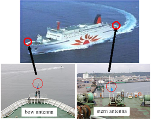
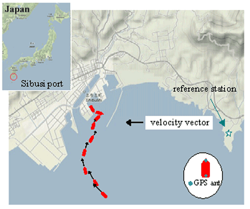
A lightering operation is a type of Ship-To-Ship (STS) operation where two ships are together in open waters and transfer the cargo e.g. crude oil, LNG. High skills and experience are required by the human operators as no relevant equipment for determining the relative speeds and distances with sufficient accuracies has been implemented. The officer in charge of an STS lightering takes the decision on adequate maneuvering orders based on predominantly visual observations during the final approach. Landing on all fenders simultaneously is an objective in order to minimize ship-fender contact forces, but this is rather difficult to achieve in practice even in calm sea due to the effect of hydrodynamic interaction when the ships are closing in. Furthermore, currents that are present in the lightering zone add to the operational complexity. A field measurement experiment has been carried out with a Velocity Information GPS (VI-GPS) system installed onboard a ferry approaching port for berthing which is similar to an STS lightering. The paper proposes to apply VI-GPS as input sensor to a decision-support and guidance system aiming to provide accurate velocity information to the officer in charge of an STS operation. It is argued that DOP VI-GPS is related to the velocity error.
|
|